Where is Quang Binh in Vietnam? Located in the heart of the North-Central Coast, Quang Binh Vietnam is a land of extremes. It is home to the world’s largest cave, the narrowest point of the country, and some of the most resilient people in history. In this massive guide, we explore the Quang Binh area in Vietnam, its borders, and why its unique location makes it the ultimate adventure hub for 2026.
Overview of Quang Binh Vietnam
Quang Binh Vietnam is a province that defines the “S-shape” of the country. With a total natural area of approximately 8,065 square kilometers, it serves as a bridge between the north and the south.
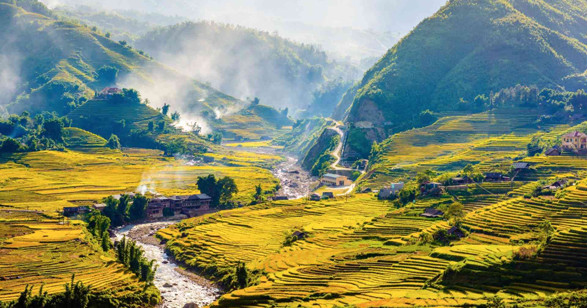
While much of the Quang Binh area in Vietnam is covered by lush primary forests and rugged limestone mountains (about 85% of the terrain), the province also boasts a 116km coastline with white sand beaches. In 2026, the province is projected to welcome over 7 million visitors, making it one of the fastest-growing tourism sectors in Asia.
Where is Quang Binh in Vietnam?
When people ask “Where is Quang Binh in Vietnam?“, the most famous answer is that it sits at the narrowest point of the country.
The Narrowest Point of the S-Shape
In the district of Quang Ninh, the distance from the Laotian border in the west to the East Sea in the east is only 40.3 kilometers (about 25 miles). This thin strip of land is squeezed between the Truong Son Mountains and the Pacific Ocean.
Geographical Zones
The Quang Binh area in Vietnam is divided into four distinct geological zones:
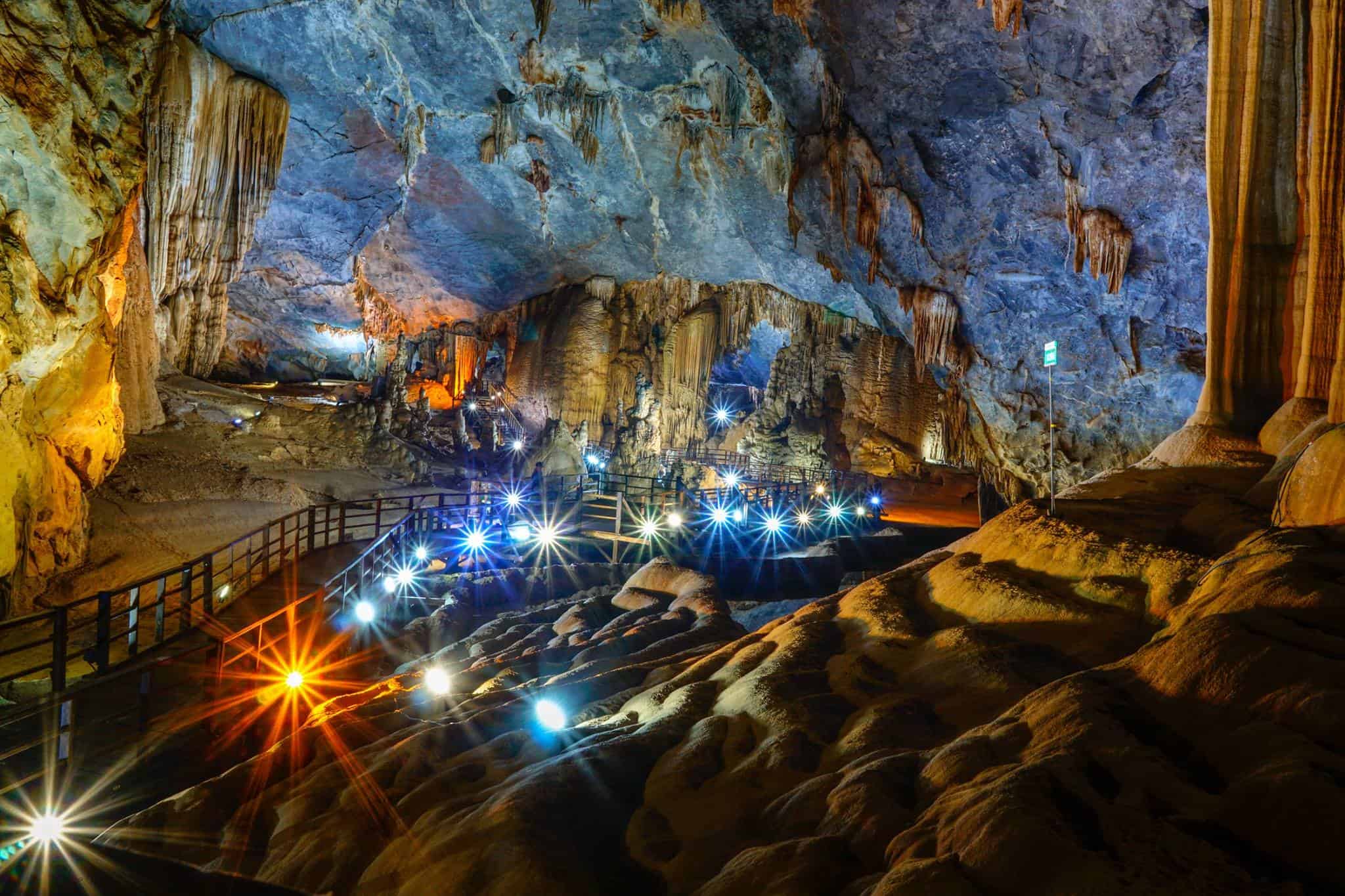
- Mountainous Zone: The western frontier, home to the UNESCO Phong Nha-Ke Bang National Park.
- Hilly Zone: A transitional area famous for pepper and rubber plantations.
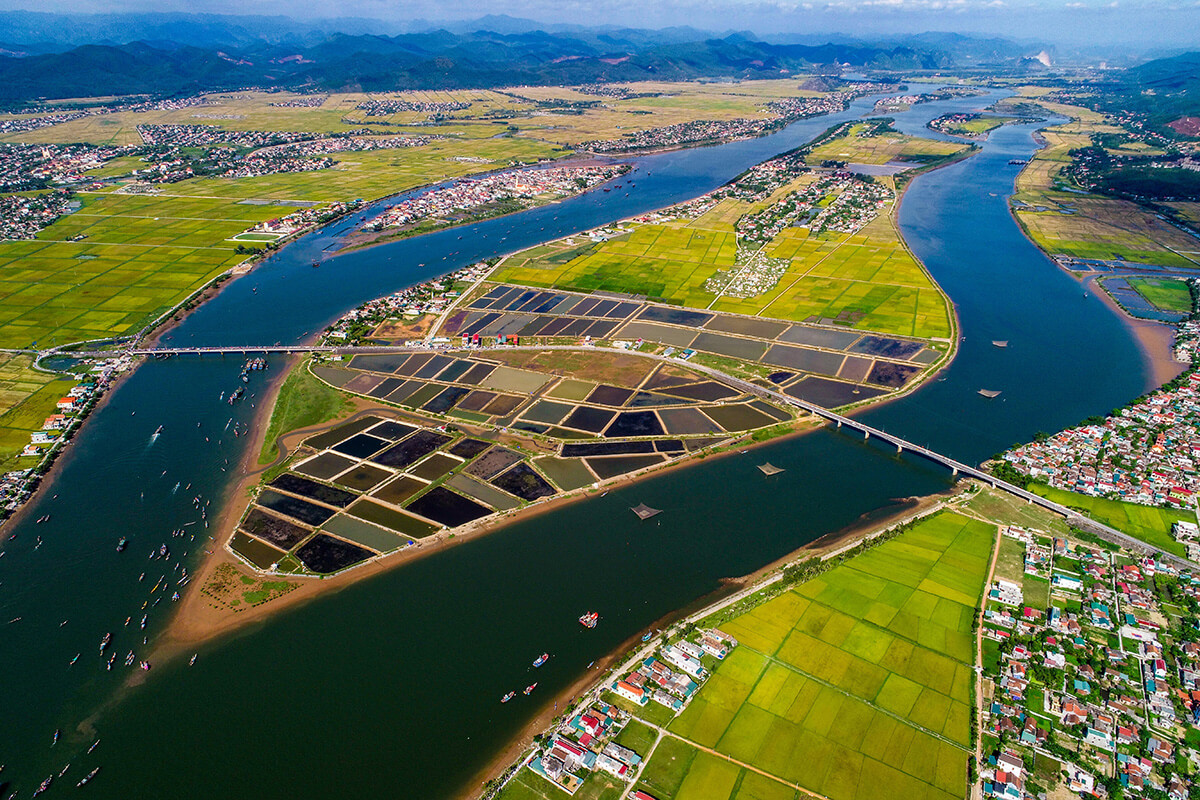
- Plain Zone: The fertile agricultural heartland along the Gianh and Nhat Le rivers.
- Coastal Sand Zone: Dramatic white dunes like Quang Phu that protect the inland from the sea.
Which Province Borders Quang Binh?

Strategic planning for your Vietnam trip requires knowing who the neighbors are. Quang Binh Province is bordered by:
- North: Ha Tinh Province, separated by the historic Hoanh Son Mountain Range and the Ngang Pass.
- South: Quang Tri Province, the gateway to the DMZ and the historic 17th parallel.
- West: The international border with Laos (Khammouane Province). This 201km border is a major trade and travel route via the Cha Lo Border Gate.
- East: The East Sea (South China Sea), providing a gateway for maritime trade and tourism.
How to Get to Quang Binh Vietnam
Knowing how to get to Quang Binh is essential, as the province is accessible by land, sea, and air.
By Air: Dong Hoi Airport (VDH)
Located just 6km from the center of Dong Hoi City, the airport connects you to Vietnam’s major hubs.
- From Hanoi: 1 hour 15 mins (Daily flights).
- From Ho Chi Minh City: 1 hour 40 mins (Daily flights).
- Pro Tip: In 2026, many travelers prefer early morning flights to maximize their first day at the caves.
By Train: The Reunification Express
Dong Hoi is a major stop on the North-South railway.
- From Hue: 3 hours ($6 – $10).
- From Da Nang: 5–6 hours ($10 – $25).
- From Hanoi: 10 hours (Overnight sleeper trains are the best way to save on a hotel night!).
By Bus: Luxury Sleeper Coaches
Daily buses from Camel Travel, Hung Long, and Queen Cafe run from Hanoi, Hue, and Da Nang. A sleeper bus from Hanoi typically takes 9–10 hours and drops you off in the heart of Phong Nha.
Top Places to Visit in Quang Binh Province
The Quang Binh area in Vietnam is packed with world-record attractions:
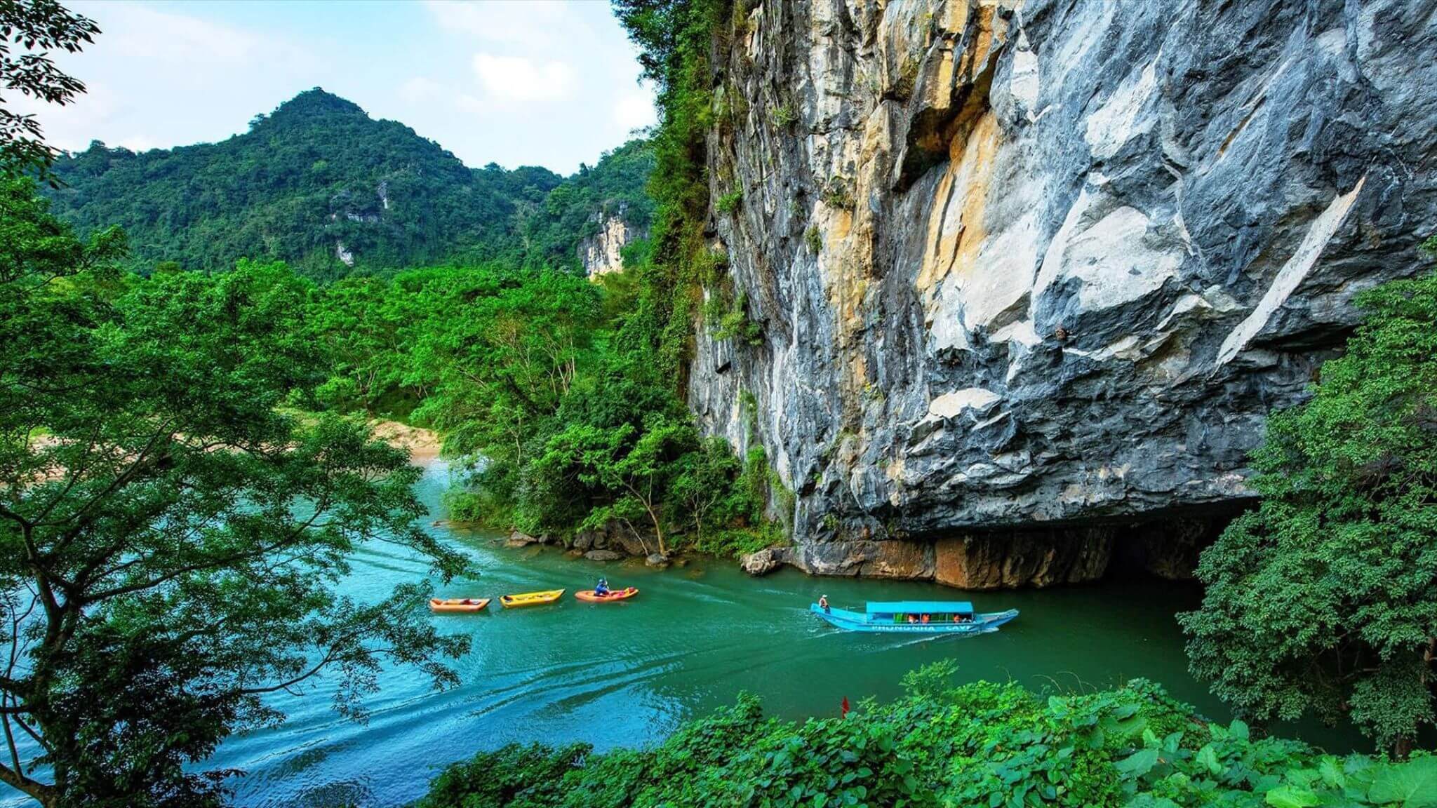
- Son Doong Cave: The world’s largest cave.
- Paradise Cave (Thien Duong): Asia’s longest dry cave, famous for its “Royal Palace” interior.
- Dark Cave (Hang Toi): The hub for ziplining and mud baths.
- Mooc Spring: A turquoise paradise perfect for kayaking and swimming.
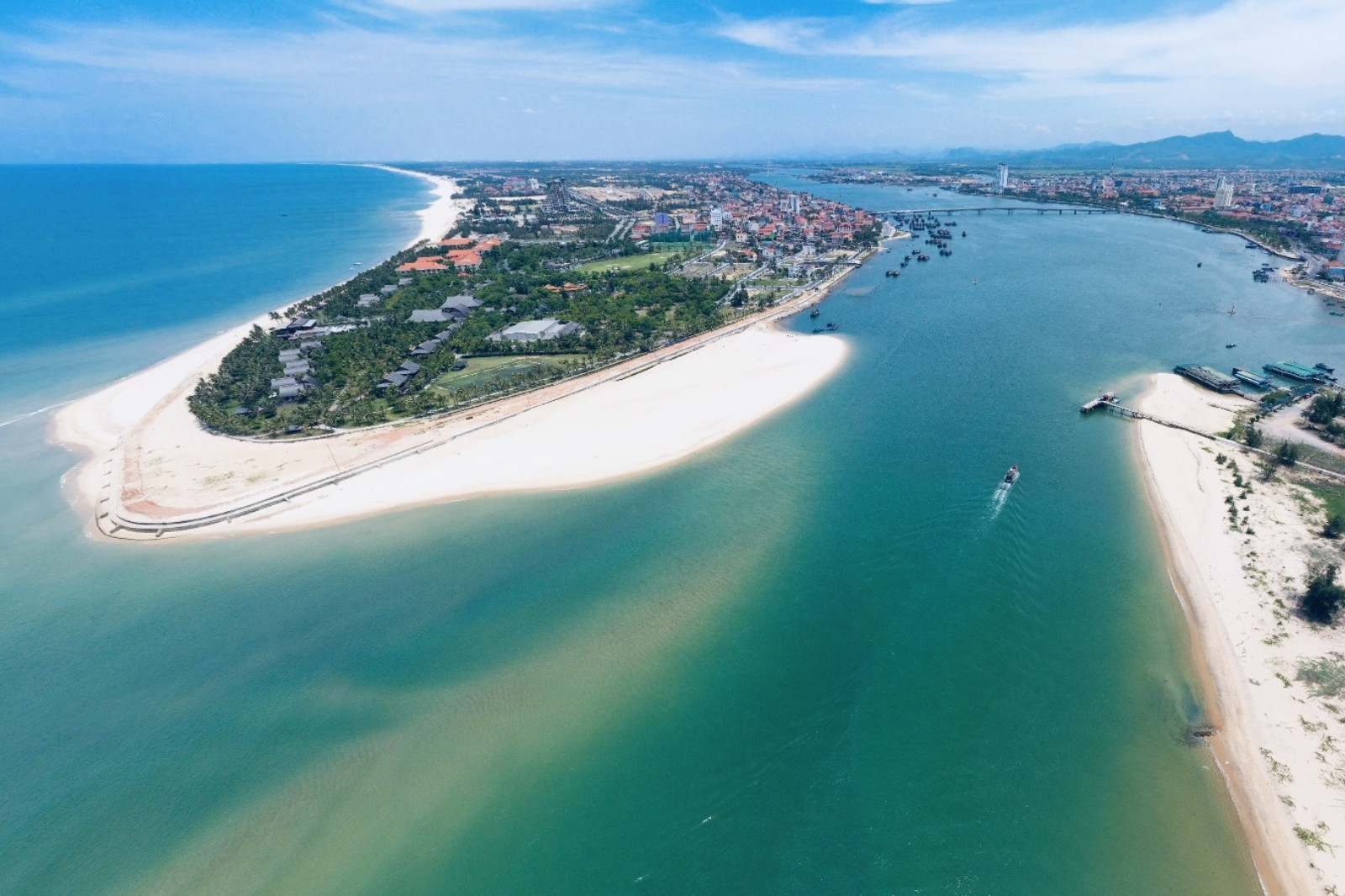
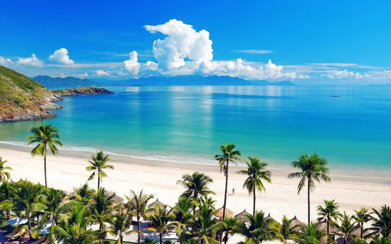
- Nhat Le Beach: Voted as one of the 10 most beautiful beaches in Vietnam.
Other Famous Places Near Quang Binh
If you are staying in Quang Binh Vietnam, you are perfectly positioned for day trips to nearby provinces:
- Vinh Moc Tunnels (Quang Tri): A 1.5-hour drive south.
- Hue Imperial City: A 3-hour drive south.
- Phong Nha – Hue – Hoi An: Most travelers follow this “Heritage Trail” to see the best of Central Vietnam.

Read more: Unforgettable Hue Vietnam Itinerary: 5 Days of Discovery
FAQs: Understanding the Quang Binh Area in Vietnam
1. Where exactly is Quang Binh in Vietnam?
Quang Binh Vietnam is located in the North-Central Coast region of the country. It is famously situated at the narrowest point of the S-shaped map, with the distance from the western border with Laos to the eastern coastline being only 40.3 kilometers. This unique position makes it a strategic hub connecting the North and South of Vietnam.
2. How do I get to Quang Binh from major cities?
Knowing how to get to Quang Binh is easy because of its central location.
-
By Air: Fly into Dong Hoi Airport (VDH) from Hanoi (1h 15m) or Ho Chi Minh City (1h 40m).
-
By Train: Take the Reunification Express to Dong Hoi Station. It takes about 10 hours from Hanoi and 3 hours from Hue.
-
By Road: Luxury sleeper buses run daily from Hanoi, Hue, and Da Nang. The drive from Hanoi takes approximately 9–10 hours.
3. Which province borders Quang Binh?
Quang Binh Province shares borders with three distinct regions:
-
North: Ha Tinh Province (via the Ngang Pass).
-
South: Quang Tri Province (gateway to the DMZ).
-
West: The country of Laos (Khammouane Province).
-
East: The East Sea (South China Sea).
4. What is the best time of year to visit the Quang Binh area in Vietnam?
The dry season (March to August) is the peak time for tourism. During these months, the weather is hot and dry, making it the ideal time for trekking in Phong Nha-Ke Bang National Park and exploring the caves. The rainy season occurs from September to February, which may lead to some caves closing due to rising water levels.
5. Is Quang Binh famous for anything other than caves?
Absolutely! Beyond its world-record caves, the Quang Binh area in Vietnam is famous for:
-
Pristine Beaches: Nhat Le and Bao Ninh are top-tier coastal destinations.
-
Historical Landmarks: The Mother Suot Monument and the ancient Quang Binh Gate.
-
Spiritual Sites: The burial site of General Vo Nguyen Giap at Vung Chua – Dao Yen.
Conclusion
Now that you can answer “Where is Quang Binh in Vietnam?“, it’s time to see it for yourself. From the narrowest plains to the deepest caves, Quang Binh Province is a land of wonder that rewards the curious traveler.
Book with Vietnam Tour 247
Don’t let the logistics of the Quang Binh area in Vietnam overwhelm you. At Vietnam Tour 247, we specialize in high-quality, professional tours tailored to your needs. From airport transfers to luxury cave expeditions, we are your local experts.
- Website: Vietnamtour 247
- Hotline: (+84) 979133907
- WhatsApp: (+84) 916289247
- Email: sales@vietnamtour247.com
- Vietnam: 128 Ngoc Tri St, Long Bien District, Hanoi
Vietnam Tour 247 – Explore the Heart of Vietnam with Confidence!